The Scandibérique, a cycle route sticking close to waterways!
Cycling along the Scandibérique allows you to enjoy an intensive lesson in French river geography, as this route really has a strong riverine DNA!
Going north to south, head off to discover this water-hugging cycle route!

The Sambre : a Franco-Belgian river, a tributary of the Meuse
It runs along for some 190km. Its source is in France, in La Haie-Equiverlesse Wood, in the parish of Fontenelle, near Le Nouvion-en-Thiérache. The Scandibérique actually follows the Sambre Canal between Namur and Maubeuge. Steel- and glass-works, slag heaps and workers’ houses recall the important industrial and mining past of the Charleroi area. But more bucolic settings with woods and meadows also crop up, for example around the medieval villages of Thuin and Lobbes.

The Oise, 341km navigable long river
This 341km-long river is navigable along practically its entire length and has canals running parallel to it for 104km. Its source is in Belgium, in the Bois de Bourleurs Forest near Chimay. It’s one of the Seine’s main tributaries, second only to the Marne in size. The Scandibérique follows the Oise for over 100km, notably leading you along the Axe Vert de Thiérache, taking you through hedge-divided countryside shaped by this capricious river, liable to breaking its banks.

The canal de l’Ourcq, an umbilical cord
An umbilical cord connecting Mareuil-sur-Ourcq to Paris via the Bassin de la Villette, this canal built between 1802 and 1822 runs for 97km, with six locks. Coming from the north, the Scandibérique route joins the canal at Gressy, from where you can cycle serenely along the towpath to the edge of the French capital.

The Saint Martin Canal by bike
A charming canal just 4.55km long, crossing central Paris’s 10th and 11th arrondissements, connecting the Bassin de la Villette to the Port de l'Arsenal, Paris’s yacht harbour, and joining the Seine south of Place de la Bastille. Opened in 1825, it has nine locks and two swing bridges. Along with the Saint Denis and Ourcq Canals and the Bassin de la Villette, it makes up Paris’s canal network, extending for 130 km.

The Seine, one of France’s major rivers
One of France’s major rivers flowing 775km all the way to the sea. It has shaped the greater Paris Basin and crosses the cities of Troyes, Paris, Rouen and Le Havre before reaching the Channel. Its source is at Source-Seine, 446m in altitude, on the Langres Plateau, in Burgundy’s county of Côte-d'Or. In its upper reaches, fine riverside homes and châteaux from the 17th to 19th centuries give sections of the Seine’s banks a resort-like feel, contrasting strongly with the signs of 19th-century industrialisation that you can glimpse along the Scandibérique approaching Paris, at the level of Corbeil.

The Loing and its canal
A Seine tributary, crossing the counties of Yonne, Loiret and Seine-et-Marne on its 143km journey, the Loing’s source lies in the newly-created parish of Treigny-Perreuse-Sainte-Colombe in Yonne. Strategically important for supplying food to Paris, the Loing Canal was begun in 1720. Via its 49km, it links the Briare and Orléans Canals, making use of the riverbed on eight occasions. It provides cyclists on the Scandibérique with one of the most bucolic sections along the route.

The canal de Briare by bike
An essential link for navigation on France’s waterways, the 54km and 38 locks of the Briare Canal make it possible to go between the Seine and Loire Rivers by water. One of the oldest canals in the country, it was the prototype for all modern canals that take boats via a summit section connecting watersheds. From the hamlet of Buges in the Loiret (not far from Montargis), the Scandibérique follows the Briare Canal, leading you peacefully to the Loire Valley.

The Loire, France’s Valley of the Kings
With its watershed covering 117,000km2, or a fifth of mainland France, the Loire is the country’s longest river, at 1,006km in length. It starts out on the south side of the Mont Gerbier-de-Jonc in Ardèche, in the southeast corner of the Massif Central Range, and ends at its estuary in the county of Loire-Atlantique, where it flows into the ocean. Between Briare and Tours, the Scandibérique adopts the same path as the Loire à Vélo cycle route, allowing you to enjoy France’s Valley of the Kings.

The Vienne by bike
His river is 363km in length, its source in the county of Corrèze, on the Millevaches Plateau at the foot of Mont Audouze, at an altitude somewhere between 860m and 895m. It crosses the county of Creuse for just 2km, then runs through the county of Charente, followed by two counties that carry its name – Haute-Vienne and Vienne – finishing in the county of Indre-et-Loire. One of the Loire’s most significant tributaries, along with the Cher and Allier, it transports the largest volume of water of the three. It serves as the Scandibérique’s thread from Marcilly-sur-Vienne to Exideuil-sur-Vienne.

The Touvre, just 12km length
A mini tributary of the Charente River, just 12km in length. Among its unusual features is the fact that it’s as wide at its source as it is at its confluence! You follow both the Bandiat and Touvre Rivers along the Scandibérique as a link between the larger Vienne and Charente Rivers.

The Charente, the guiding thread for La Flow Vélo cycle route
A river that takes 381km to wend its way to the Atlantic, the Charente is characterized by its many meanders, which double its length from source to estuary compared with how the crow flies. Its source has been geolocated to Chéronnac, in the county of Haute-Vienne, at an altitude of 295m. The Charente serves as the guiding thread for La Flow Vélo cycle route, the Scandibérique sharing its path between Marthon and Châteauneuf-sur-Charente.

The Isle joins the Dordogne River
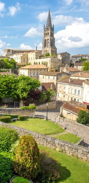
This river’s source is in the Massif Central mountains, in the county of Haute-Vienne, south of the hamlet of Rongeras, at 375m in altitude. It runs for 255km, 87km of which are navigable. It joins the Dordogne River at Libourne, a stopover town on the Scandibérique.

The Dordogne
This major river is in fact a tributary of the Garonne. Its source lies on the Puy de Sancy, the highest mountain (1885m) in the Monts Dore Range and the greater Massif Central mountains. The Dordogne measures 483km in length and is navigable downstream of Libourne. The Scandibérique runs beside and crosses the Dordogne going from the vineyards of the Libournais area across to the Entre-deux-Mers area (the two ‘‘seas’’ in that name referring to the Dordogne and Garonne Rivers).

The Garonne and his canal by bike
This great river’s source in fact lies on the Spanish side of the Pyrenees. It flows for 647km before reaching the Atlantic Ocean. When joined by the Dordogne, the two create the mighty Gironde Estuary. The Scandibérique flirts with the Garonne at the level of Bordeaux, then upstream, between Langon and Vianne. The Garonne is navigable up to Langon.

The Baïse, open to pleasure boats!
Flowing for almost 188km, the Baïse’s source lies on the Lannemezan Plateau, towards Capvern-les-Bains, in the county of Hautes-Pyrénées. It joins the Garonne at Saint-Léger, slightly upstream of the confluence of the Lot and Garonne Rivers. It’s only open to pleasure boats now, on the stretch between Valence-sur-Baïse and its confluence with the Garonne. The Scandibérique leads you through the charming river port of Buzet-sur-Baïse, running alongside this enchanting river up to Lavardac, then shifting to follow the Gélise River.

The Douze, The Midou et The Midouze
Three rivers offering a good example of a confluence and a portmanteau word! The first contributor to the Midouze, the Douze crosses the counties of Gers and Landes on its 124km journey. Its source is in the Armagnac area, at Baccarisse in the Gers. At Mont-de-Marsan, it joins the Midou to create the Midouze. The Midou, or Midour in Gascon, also begins in Armagnac country in Gers, at Armous-et-Cau, and runs for 108km. At the level of Mont-de-Marsan, the Midouze, a tributary of the Adour formed by the sandy waters of the Douze and the silty waters of the Midou, heads off on a 43km journey to its confluence. Before 1903, river transport thrived between Mont-de-Marsan and Bayonne. The cycle route follows the Douze Valley between Cazaubon and Labastide d’Armagnac, then the Midou takes over up to Mont-de-Marsan.

The Adour, a salmon river
This river’s source is up at the Tourmalet Pass in the Pyrenean Pic du Midi du Bigorre Range, in the county of Hautes-Pyrénées. Its waters run down for 308km to the point where they reach the Atlantic, with Tarnos on the north bank, L’Anglet on the south bank. One special feature – this is one of the rare European rivers to still provide salmon with spawning grounds. The Scandibérique follows the Adour’s banks between Pontoux-sur-l’Adour and Urt.

The Bidouze
This river’s source comes from a small underground lake called Eltzarreko Ordokia, north of Les Arbailles Forest. It then flows for 82km before adding its waters to those of the Adour at Guiche, in the county of Pyrénées-Atlantiques. From Guiche to Larceveau, the Scandibérique keeps in contact with the Bidouze, even if, between Escos and St-Martin, it prefers the company of the Gave d’Oloron.
Other rivers you will come across during your cycling trip
The Solre
Just 23km in length, this little river is a tributary of the Sambre. Along the Scandibérique, you take a greenway alongside it between Ferrières-la-Grande and Choisies, passing close to the river’s source at Solre-le-Château.
The Cher
A tributary of the Loire, this river runs for 365km. Its source stands at 714m in altitude, in the county of Creuse and the parish of Mérinchal. Its confluence with the Loire is in the county of Indre-et-Loire. One unusual fact about this confluence is that, since 1778, it has been at the place called the Bec du Cher, in the parish of Villandry, but its former confluence lay further downstream, at the level of Rupuanne and Bréhémont – in fact, the riverbed of the Old Cher can still be seen. The Scandibérique runs alongside the Cher as you cycle out of Tours via the Honoré de Balzac island park.
The Bandiat
Tardoire, this river flows through three counties, Haute-Vienne, Dordogne and Charente, on its 91km-long journey. One distinctive feature is that, along one section, its waters disappear into underground karstic cavities, only partially when the water level is high, but completely when the water level is low. Some of the waters flowing underground then feed the second-largest river exsurgence (or karstic spring) in France, the re-emergence of the waters known as the Sources of the Touvre.
The Gélise
92km in length, the Gélise River’s source is at Cahuzères, north of Lupiac, in the county of Gers. It then flows northwestwards in the direction of Eauze. Its waters join those of the Baïse just after passing below the fortified mill at Lavardac. The Scandibérique leaves it at the level of St-Pé-Saint-Simon, after a little detour via the Osse Valley between Sainte-Catherine and Mézin.
The Osse
This river’s source is on the Lannemezan Plateau, at the level of Bernadets-Debat, on the border between the counties of Hautes-Pyrénées and Gers. It mainly flows through this latter county, crossing it south to north, travelling 120km before joining the Gélise at the level of Nérac.
From St-Jean le Vieux, Laurhibar (28km in length) and La Nive d’Arnéguy (21km in length) are little rivers that the route follows for just a few kilometres before crossing into Spain. Both little rivers are tributaries of the Nive River.