arrow_back
Confolens / Massignac La Scandibérique
Along the water
37,68 Km
2 h 31 min
I cycle often
37,68 km cycling route from Confolens to Massignac
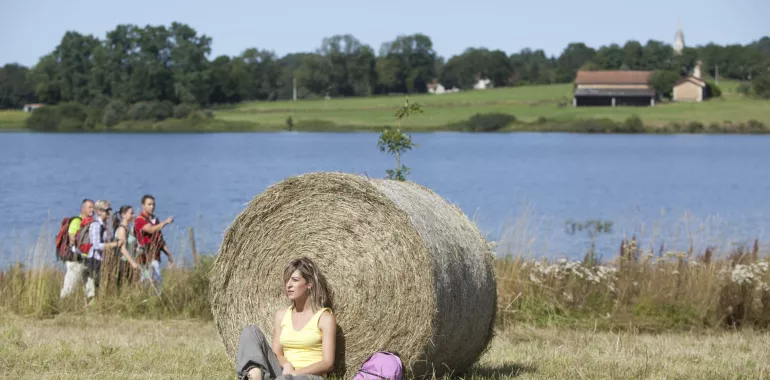
Leaving Confolens’s medieval bridge behind, the route takes you beside the Vienne River up to Exideuil, the way revealing more and more of the Charente area’s character, the Château de la Chétardie even being the seat of a Confrérie du Cognac, a fraternity for the famed brandy spirit! In this eastern part of the county, or département, of Charente, the lakes of Lavaud and Mas Chaban were created to help regulate the lack of water in the Charente River certain summers; they also offer nautical activities and places for bird-watching, nice ways to take a break before riding on to Massignac, just a few kilometres on, and a place for a stopover on the route.
Elevation of the stage
307 m m
Waytypes of the stage
Cycle path: 0,29 km By road: 37,39 km
Surface of the stage
Smooth: 30,66 km Unknown: 7,03 km
The route
Along minor roads with some good slopes. This stage is physically demanding. Take care at the junctions with the D948 road at Confolens and the RN141 road after Exideuil. Signposted EV3.
Surfacing smooth: asphalt
Trains
- Confolens train station
- Exideuil train station
Don’t miss
- Confolens: the architectural legacy around this Cité de Caractère, boasting 1,000 years of history
- Exideuil: the church of St Andrew and its baptistry; the Château de la Chétardie
- Lakes of Lavaud and Mas Chaban
- Nearby: Chassenon: Cassinomagus, archaeological park
Travellers’ reviews