arrow_back
Clérac / Libourne La Scandibérique
Forest and moorland
46,09 Km
3 h 05 min
I begin / Family
46,09 km cycling route from Clérac to Libourne
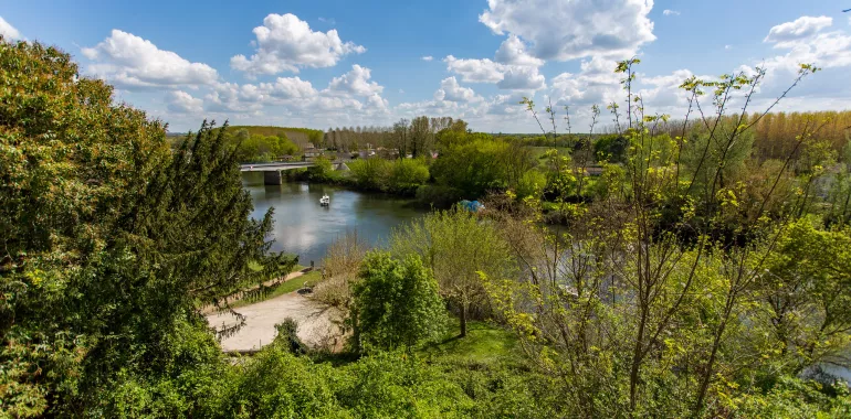
Clérac offers a haven of peace, nestled in its green wooded corner at the southern edge of the Saintonge area. The Scandibérique then leads you into the Bordelais area. At first, up to Guîtres, as well as the green of the pines, the bright white of former kaolin clay mines stands out, while the lakes that have formed in these pits reflect the deep blue of the sky. Next, the scenery changes, as you cycle beside the Isle River, the slopes covered with world-famous vineyards as you approach Libourne, an historic port at the confluence of the Isle and Dordogne Rivers. By now, the feel is very southern!
Elevation of the stage
143 m m
Waytypes of the stage
By road: 46,09 km
Surface of the stage
Smooth: 9,33 km Unknown: 36,76 km
The route
Stage along minor roads, without any particular difficulties. At St-Denis-de-Pile, you need to pass via the former railway tunnel on foot. There is a branch connecting to Coutras, 5km from the route, with its SNCF train station and other facilities. Signposted EV3.
Surfacing smooth: asphalt.
Trains
Coutras and Libourne train stations: regional TER line - Angoulême < > Bordeaux
Libourne train station: high-speed TGV line for Poitiers, Tours and Paris
Don’t miss
- Clérac: Musée des Métiers et des Traditions populaires (on local arts and crafts); church of Saint-Vivien (11th to 15th centuries)
- Cercoux: church of Saint-Saturnin (12th to 13th centuries)
- Guîtres: Notre-Dame abbey church (11th century); Le Guicherot Fountain, an historic spring
- St-Denis-de-Pile: Romanesque church of St-Denis (12th century); suspension bridge over the Isle River
- Libourne: the historic clock tower, the Tour de l’Horloge (14th century); the Musée des Beaux-Arts et de l’Archéologie (on arts and archaeology); the Hôtel de Ville, or town hall
Travellers’ reviews